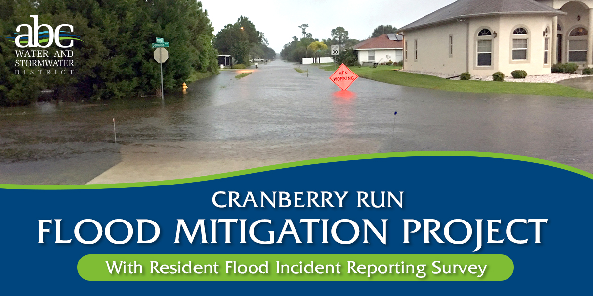
CRANBERRY RUN FLOOD MITIGATION
The Cranberry Run Flood Mitigation Project is a major infrastructure initiative designed to protect over 250 properties, businesses, and roadways from severe weather flooding.
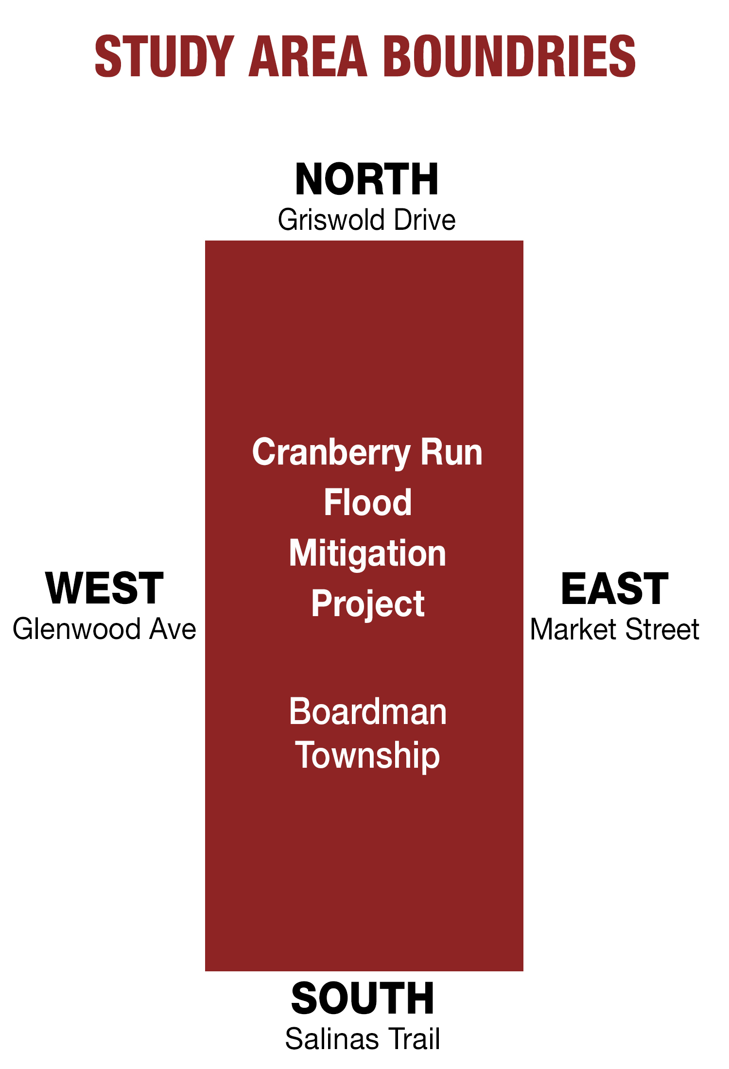
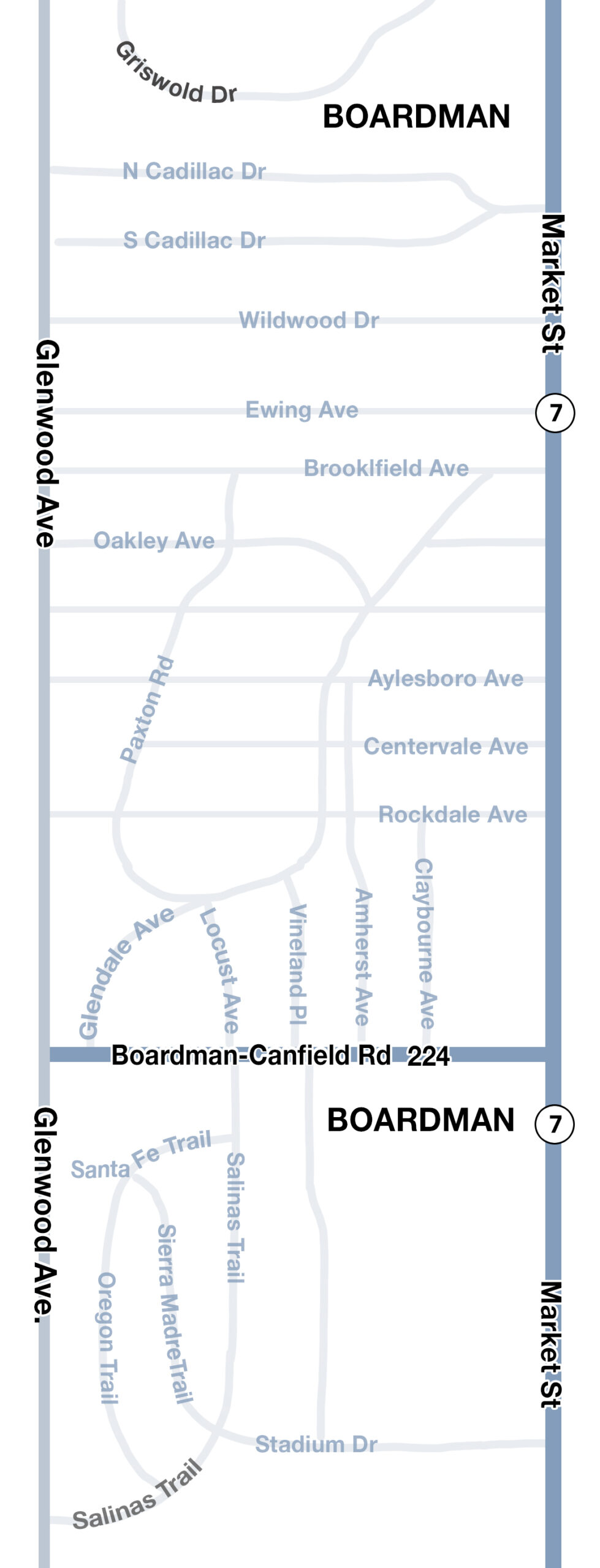
The geographic segment of the township that is the focus of the project is located between Market Street and Glenwood Avenue. Also far south as Salinas Trail and Santa Fe Trail, and as far north as Griswold drive. (See map and diagram)
Because many of our neighborhoods were built decades ago without modern stormwater management systems, this project updates our infrastructure to handle today’s heavy rain events, more quickly draining streets and yards.
The project may include new stormwater conveyance and detention features, green infrastructure, stream restoration and protection, and potentially existing infrastructure replacements.
| Maps: Cranberry Run Flood Mitigation Project |
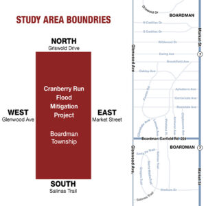 |
| Click here to see the maps larger |
How will this project mitigate flooding?
Instead of allowing heavy rainfall to overwhelm neighborhood streets and properties, the project will intercept, slow down, and safely redirect the water using a multi-pronged approach:
- Diverting the Water: A new drainage relief system (including a large conduit) will give excess stormwater its own dedicated path, moving it safely away from residential areas and directly toward Mill Creek.
- Creating Storage (Detention Basins): The project may create dedicated green spaces and stormwater detention basins (such as behind the Boardman Plaza) to act as temporary storage pools, holding water during a storm and releasing it slowly afterward.
- Stream and Floodplain Restoration and Protection: Natural waterways will be widened and restored. This restores the natural floodplain so the land can absorb excess water safely and slow down erosive flows.
- Upgrading Infrastructure: Undersized neighborhood culverts and aging storm sewers (including the Rockdale area) will be replaced with larger, modern pipes to handle flows in accordance with today’s standards.
Residents are asked to help develop the engineering study and planning by reporting flooding incidents.
To ensure the ultimate success of this historic infrastructure initiative, officials are launching a targeted community survey and research project, calling on residents to submit historical flood data, personal accounts, and photographic evidence.
Residents and property owners in the area between Market Street and Glenwood Avenue As far south as Salinas Trail and Santa Fe Trail, and as far north as Griswold drive are strongly encouraged to provide input.
Property owners within the project area (see map), especially those who have experienced recurring flooding or property damage during severe weather events in recent years—are urgently requested to participate and submit historical flood data and photos to guide multi-million-dollar infrastructure design.
“We have secured significant funding to fix these long-standing water issues, but engineering a permanent solution requires precision,” said Mark Ragozine, Boardman Township Administrator and district spokesperson.
”Our engineering teams need to know exactly how water behaves on the ground, yard by yard. By sharing your firsthand accounts and photos, you are providing the critical baseline data our engineers need to accurately design the new infrastructure. Participating in this study is a vital service to your immediate neighborhood and the entire Boardman community.”
The data-collection phase and subsequent engineering analysis are expected to take 12 to 18 months to complete. This timeline ensures a meticulous, science-based evaluation of the watershed to ensure the resulting upgrades can withstand future severe weather.
What type of flooding incident should be reported?
To streamline responses and maintain technical accuracy for the engineering model, the ABC Water and Stormwater District has focused the survey on three specific flooding events.
Residents are asked to complete the form to report any of these incidents:
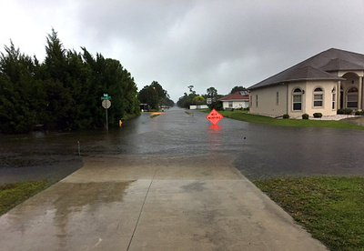
Street Ponding: Water is collecting or flooding on the street, making it difficult for cars to drive through, or unsafe for pedestrians.
Yard Inundation: Stormwater covering a large portion of your yard, creating ponds for excessive periods of time (more than 1 day), sometimes causing property damage. This may also include a stream coming out of its banks, or storm system flooding.
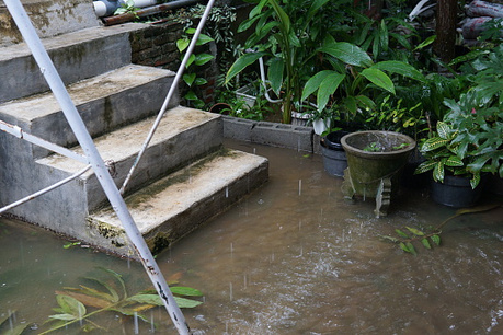
Sanitary Backup: Stormwater and wastewater pushing upward out of basement floor drains, toilets, or sinks. This may appear clear at the time, but comes from the sanitary drains (or any drains connected to your sanitary drain) in your basement.
How Residents Can Participate: Use the form below to answer the survey questions and upload any digital photographs you have taken of past flooding events directly through with the form as visual evidence is incredibly valuable to the engineering analysis.

 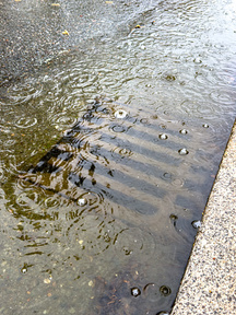 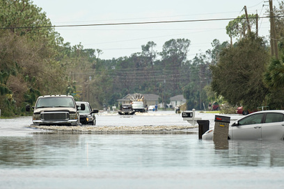 |
| Street Ponding: Water is collecting or flooding on the street, making it difficult for cars to drive through, or unsafe for pedestrians. |
 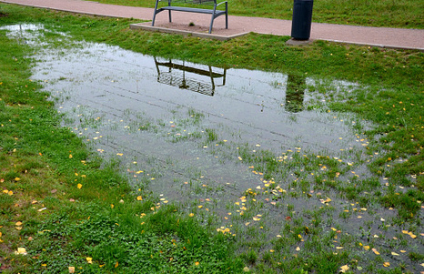 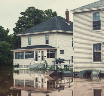 |
| Yard Inundation: Stormwater covering a large portion of your yard, creating ponds for excessive periods of time (more than 1 day), sometimes causing property damage. This may also include a stream coming out of its banks, or storm system flooding. |
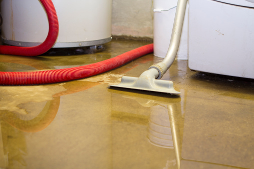  |
| Sanitary Backup: Stormwater and wastewater pushing upward out of basement floor drains, toilets, or sinks. This may appear clear at the time, but comes from the sanitary drains (or any drains connected to your sanitary drain) in your basement. |
Related Projects

Homestead Drive Stream Daylight Project

Oakridge Drive Storm Improvements

Wildwood & Ewing Storm Improvements

NPS-IS Planning
MAP-streets
street03
street02
street01
yard03
yard02
yard01
backup01
backup02